Cultural Heritage in Times of World War I: The Case of the Austro-Hungarian Relief Map of Montenegro (1916-1918)
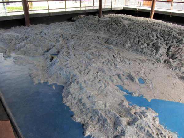
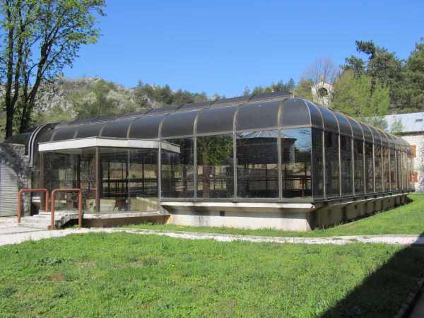
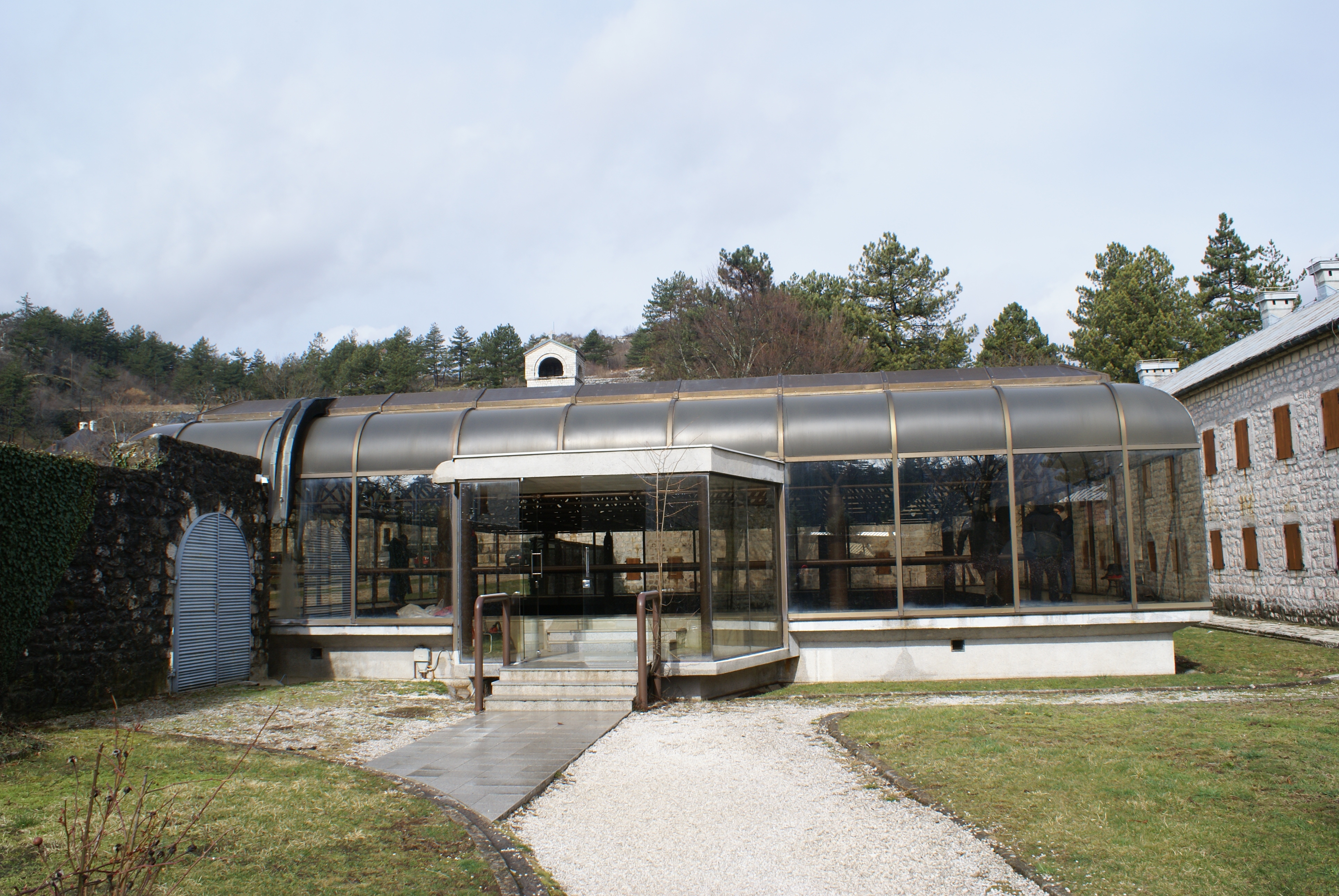
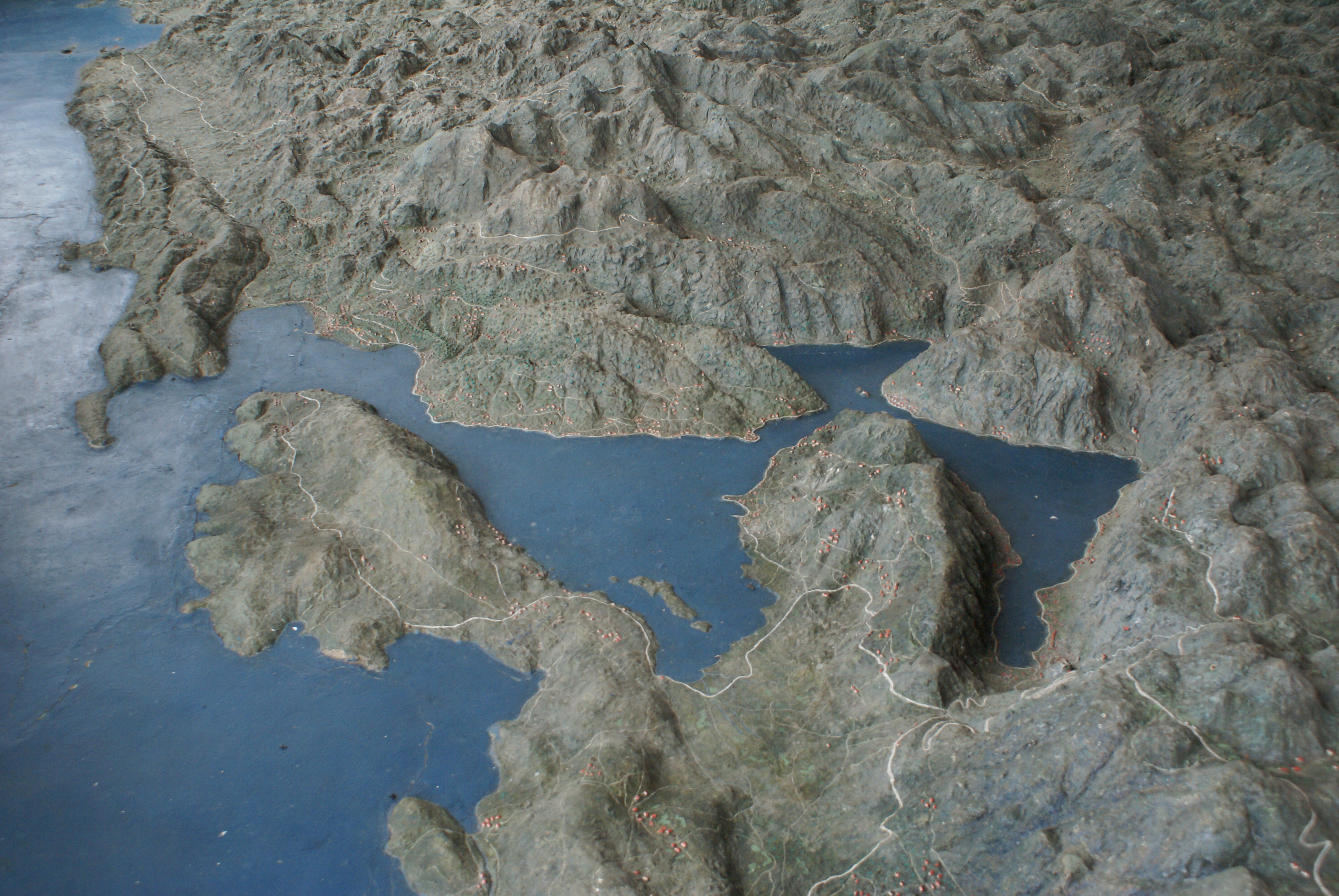
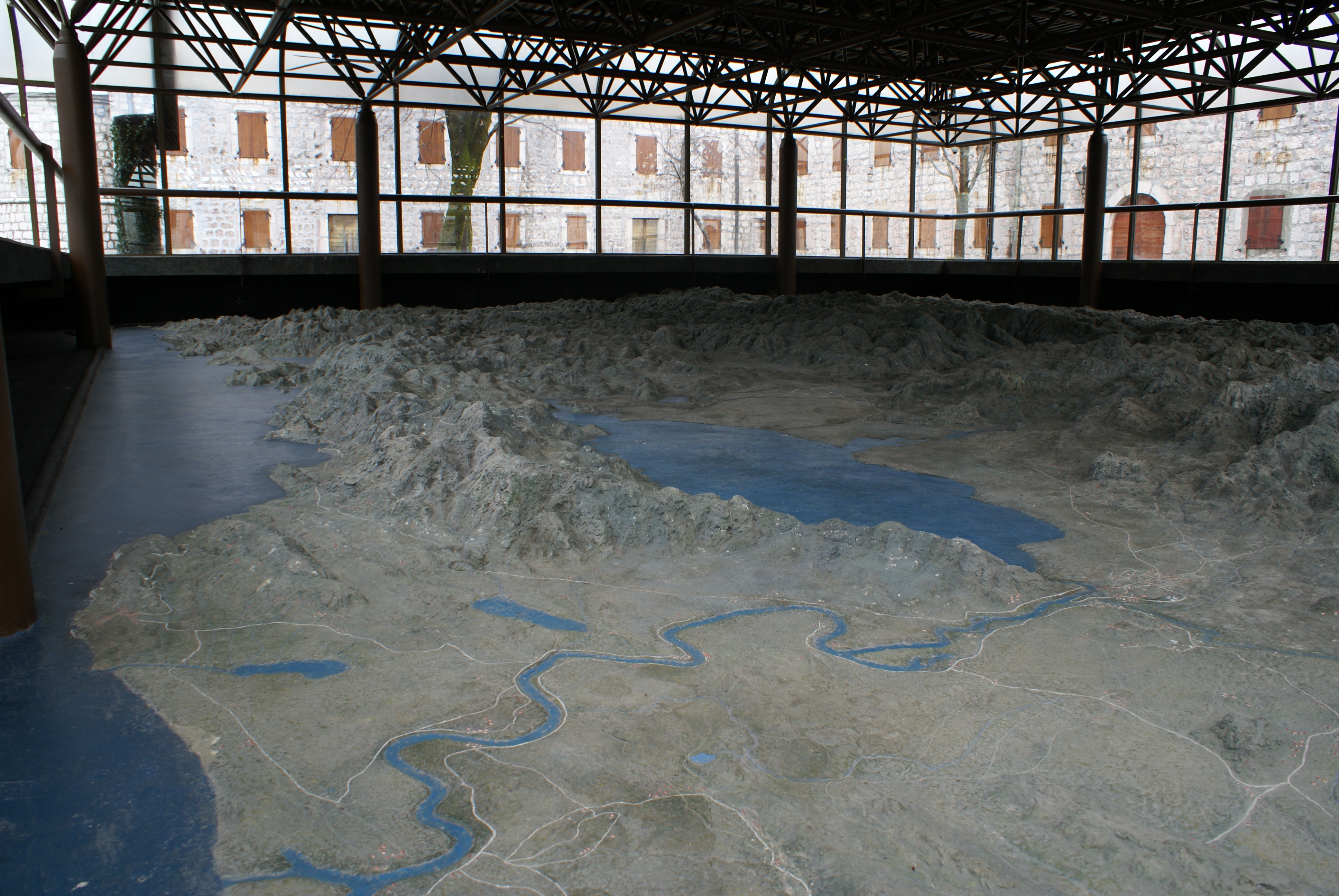
A famous example of a relief map of the Balkan Peninsula in the former Yugoslavia is the map of Montenegro and adjacent territories, which was made in 1916/17 by order of the Austro-Hungarian military administration and is now located in the courtyard of the former royal residence "Biljarda" (now the National Museum of Montenegro) in Cetinje in the Republic of Montenegro. The National Museum of Montenegro in Cetinje reports about the relief map on its homepage on the Internet as follows: "After the Austro-Hungarian army made the breakthrough of the Lovćen front and occupied Cetinje in 1916, a glazed object with a relief map of Montenegro at a scale of 1:10,000 was erected on two levels in the south wing of the "Biljarda" residence, where the headquarters of the occupation troops was also located. The relief, which shows parts of Bosnia and Herzegovina, Croatia, Albania and Serbia, among others, consists of a concrete mass on a stone base and was prepared on the basis of precise Austrian topographic maps and land surveys, which in turn had been prepared using the most modern means. To determine the elevations on the map, a network of thin metal rods was used, around which the space in between was filled manually to match the landscape characteristics. The surface was then painted in detail so that it contained all the relevant information about the road network of that time, water areas, forests and populated places. For a better overview of the map, a bridge was built over its central part, from which every single detail was visible. In addition to Austro-Hungarian military cartographers, Montenegrin prisoners of war were also involved in the production of the relief map, including our famous sculptor Marko Brežanin. The old protective superstructure was demolished in the early 1980s and replaced by a glazed metal structure, which is still in use now. The relief map of Montenegro was declared a cultural monument (cultural property) by Decision No. 1794/1 of September 14, 1948. Apart from the undoubtedly military-strategic purposes it had during the war years, this unique object has gained importance over time due to its aesthetic and historical value, so that it now forms an inevitable tourist attraction." (Translation by M. Popović)
In the description of the National Museum of Montenegro, the statement "In addition to Austro-Hungarian military cartographers, Montenegrin prisoners of war were also involved in the production of the relief map, including our famous sculptor Marko Brežanin" is of particular interest. Surprisingly, the relief map is not mentioned in Austrian scientific literature, but only finds brief mention as a tourist attraction in modern Austrian or German travel guides about Montenegro.
The aim of the project is to investigate the circumstances and general conditions of the production of the relief map by the Austro-Hungarian army and to search for the Austro-Hungarian artists who worked on the relief map of Montenegro in 1916. Among the participants were the Austrian sergeant and sculptor Schugar, the sculptor Brežanin and the painter Grabwinkler.
Funded by:

Project Number: ME 07/2019
Duration: 01.01.2019 - 31.12.2021
PI: Mihailo Popović
- Veronika Polloczek
- Bernhard Koschiček-Krombholz
- Moisés Hernández Cordero
- Jelena Nikić, BA
- University of Donja Gorica (Faculty for Culture and Tourism, Podgorica, Montenegro)
- Austrian Archaeological Institute (ÖAI) of the Austrian Academy of Sciences (Director Priv.-Doz. MMag. Dr. A. Pülz, w.M.)
- National Museum of Montenegro (Narodni muzej Crne Gore, Cetinje, Montenegro)
Results
- Establishment of contacts with scientists, archives and museums in Montenegro
- Research and Contextualization of the Austro-Hungarian Relief Map of Montenegro (1916-1918)
- Raising awareness among the Austrian public by publishing the first results in the blog of the newspaper "Der Standard" at: "Montenegro in Relief: Terra incognita in the Balkans")
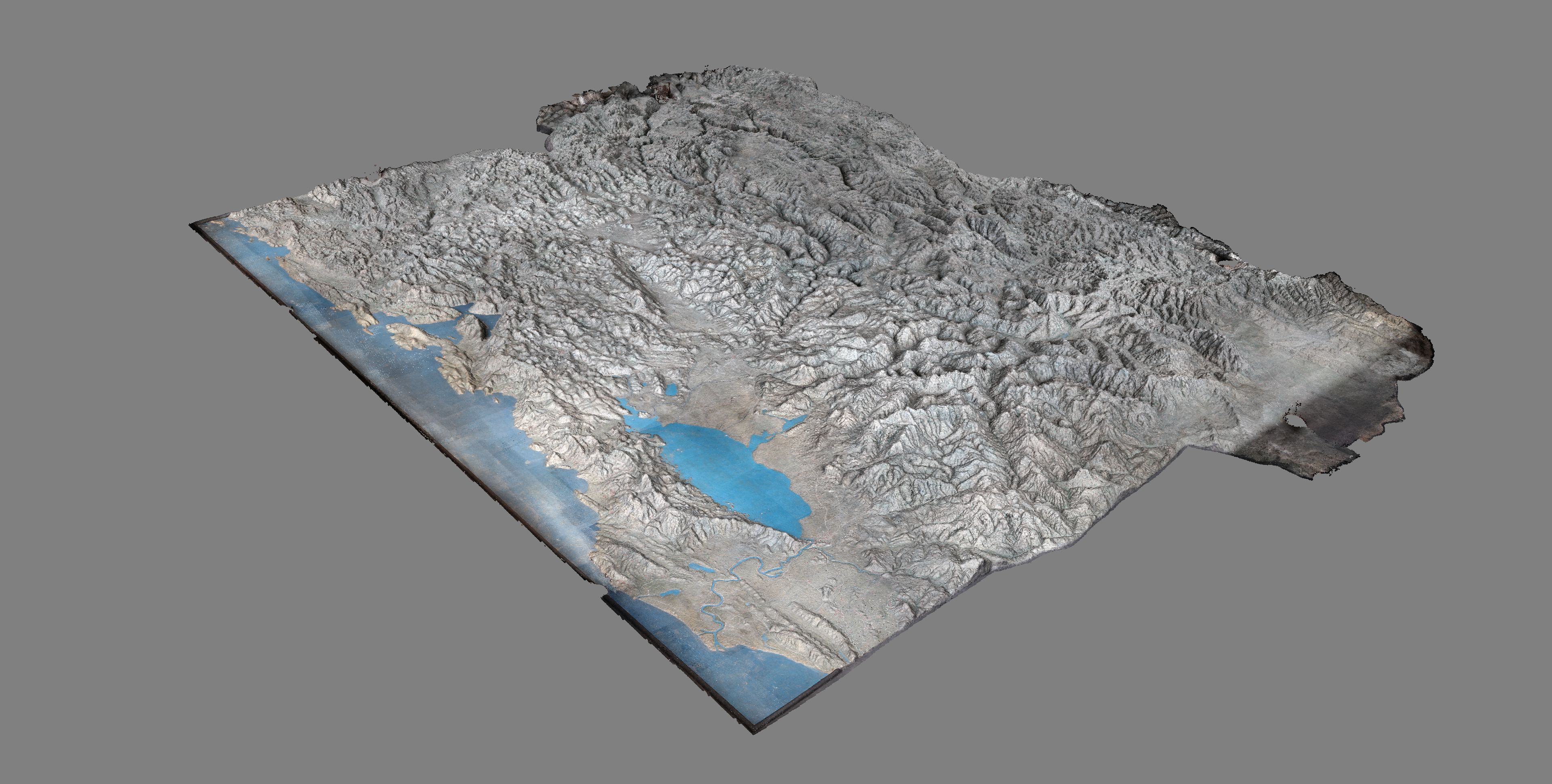
- 3D scan of the relief in the National Museum of Montenegro in Cetinje by our project team
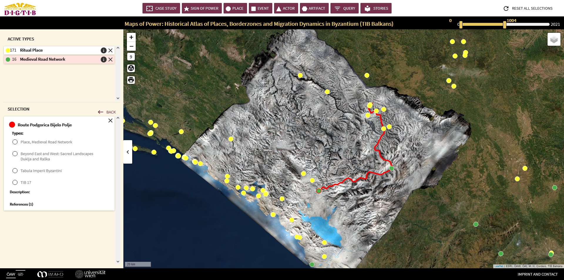
- Georeferencing the 3D model and inserting it as a layer in the web application "Maps of Power: Historical Atlas of Places, Borderzones and Migration Dynamics in Byzantium (TIB Balkans).
- Cooperation with the TIB subproject „Beyond East and West: Geocommunicating the Sacred Landscapes of ‘Duklja’ and ‘Raška’ through Space and Time (11th-14th Cent.)/HOLDURA“
- Joint scientific article of the Austrian and Montenegrin project teams entitled "On the Crossroads between East and West: Geocommunicating Medieval Sacred Landscapes in Today's Montenegro - First Project Results" published in the Austrian online journal MEMO_quer during 2022.
- Presentation of the 3D model of the relief map to the National Museum of Montenegro in Cetinje for the purpose of museum exhibitions and digital presentations.
Publications
Presentations
| Presenter | Title | Conference | Location | Date | |
|---|---|---|---|---|---|
| Mihailo Popović | „Zwei Reliefkarten des Balkans – ein ‘ungewöhnlicher’ Blick auf Skopje und auf Montenegro im ersten Viertel des 20. Jahrhunderts“ | DPP Lecture | Wien | 2018/12/18 | |
| Mihailo Popović | Vortrag über historische Geographie des Balkanraums und des Projektes vor Studierenden der Universität Donja Gorica in Podgorica | Montenegro | 2020/03/05 | ||
| Moisés Hernández Cordero | Mapping Cultural Heritage beyond the Eye: The Case of the Crown of the Serbian King Stefan Dečanski | International Medieval Congress | Leeds, Großbritannien | 2022/07/06 |