Beyond East and West: Geocommunicating the Sacred Landscapes of “Duklja” and “Raška” through Space and Time (11th-14th Cent.)

In the current discourse on the integration of the Western Balkans into the European Union the ongoing and envisaged negotiations with the Republics of Montenegro, Serbia and Albania seem to be of remarkable importance in the contemporary media coverage. They comprise a region, which – in a long ago past – played, under the name of Illyricum (Illyrikon), a vital role in the strategic and administrative considerations of the Byzantine Empire.

The project builds upon a scholarly cooperation among the academic fields of Byzantine Studies, Medieval History, Historical Geography, Art History, Geography and Geocommunication (GIScience and Cartography) and focuses on two historic regions of “Duklja” and “Raška” being part of the Illyricum. The research hypothesis is that both historic regions constituted a “Sacred Landscape”, which we intend to decipher and to communicate to academia as well as to the interested public with the joint means of Historical Geography, Art History and Geocommunication.

Therefore, the project aims at approaching and researching systematically the following three major questions:

(1) In which way did the local rulers and the Churches of Rome and Constantinople interact in the regions of “Duklja” and “Raška” from the 11th to the 14th centuries and how is this very interaction mirrored in the distribution pattern of monuments (i.e. the churches and monasteries) in this “Sacred Landscape”?

(2) Did the volatile religious affiliation of the local rulers have an impact on the “Sacred Landscape” and where were Latin or Byzantine places of worship transformed or superimposed in the course of time?

(3) Can the religious and cultural influence of the Latin and Byzantine (Orthodox) faith be traced through small Latin (i.e. “Western”) as well as Byzantine and Slavic (i.e. “Eastern”) objects of art, not only in the coastal area, but also in its hinterland and in Italy? Both historic regions could prove to be constituting a zone “Beyond East and West”, subject to remarkable processes of transformation from the 11th to the 14th centuries, and have the huge potential to offer data suitable for visualisations as well as formalisation by GIScience. The integration and presentation of the research data (i.e. on the written sources, monuments and objects of art) of the project will be achieved through an already existing database and an online map application.

The project is exclusively feasible through a multidisciplinary approach and cooperation between three project partners from Austria (Austrian Academy of Sciences, here Priv.-Doz. Mag. Dr. Mihailo Popović; University of Vienna, here Professor Dr. Karel Kriz) and Germany (Hochschule für Technik, Wirtschaft und Kultur Leipzig, here Professor Dr. Johannes Tripps).Moreover, it is closely connected to the ongoing scholarly work of Mihailo Popović on TIB volume 17 “Nea Epeiros and Praevalis” and on the TIB Subproject “Cultural Heritage in Times of World War I: The Case of the Austro-Hungarian Relief Map of Montenegro (1916-1918)”.

Funded by:

Austrian Science Fund Deutsche Forschungsgemeinschaft

Project Number: I 4330-G

Duration: 01.03.2020 - 31.08.2023

PI: Mihailo Popović

Employees:
  • Dorota Vargová
  • Bernhard Koschiček-Krombholz
  • David Schmid
Cooperation and External Employees:
  • Mag. Markus Breier
  • Lukas Neugebauer, BSc MSc
  • Florian Korn, BSc MSc
  • Dipl.-Ing. Leonhard Kreil-Brunauer
  • Ass. Prof. Dr. Branka Vranešević
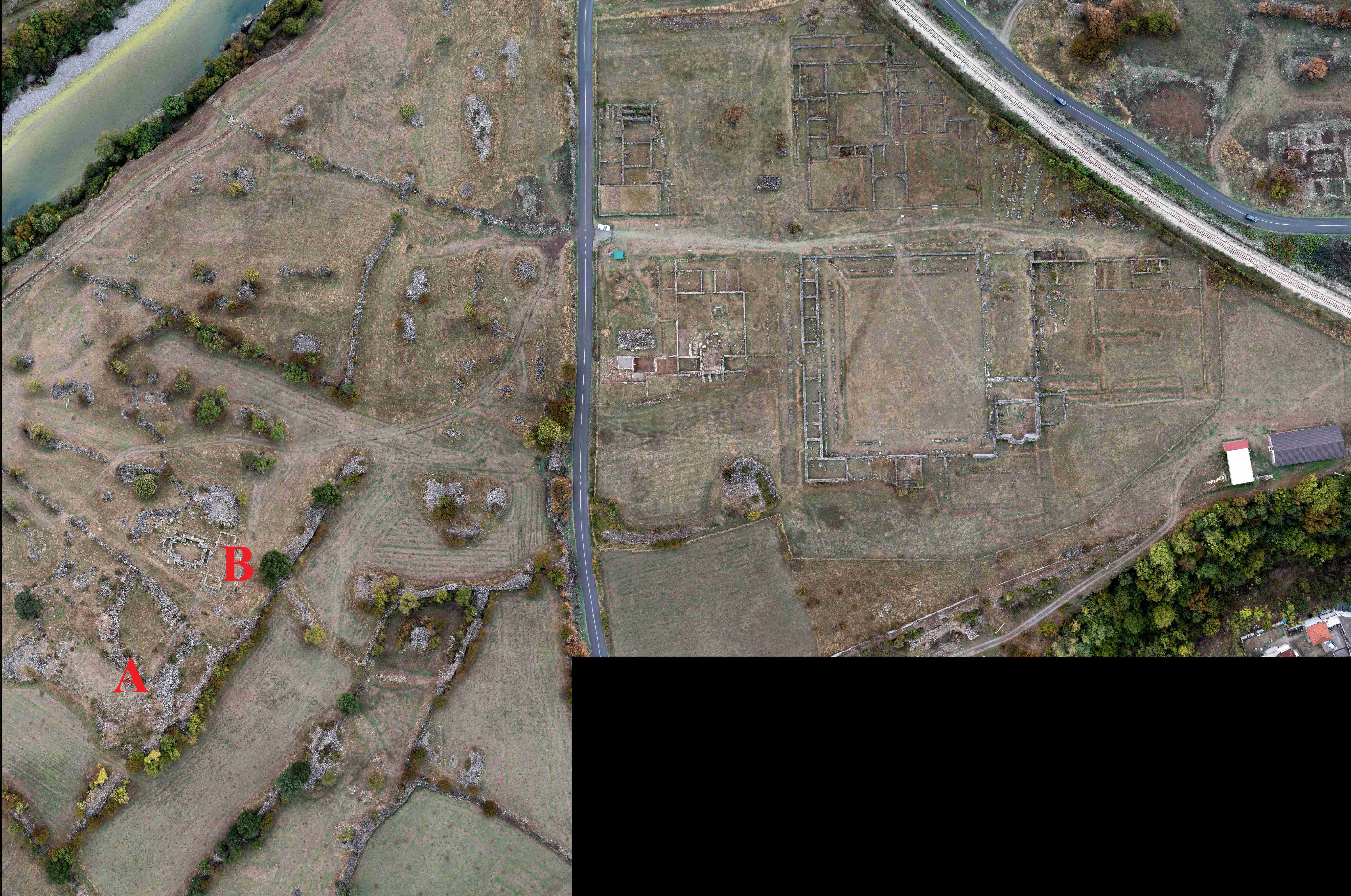
Bird's eye view of the Doclea archaeological excavation, A: Basilica A, B: Basilica B and cruciform church, Republic of Montenegro

Bird's eye view of the Doclea archaeological excavation, A: Basilica A, B: Basilica B and cruciform church, Republic of Montenegro

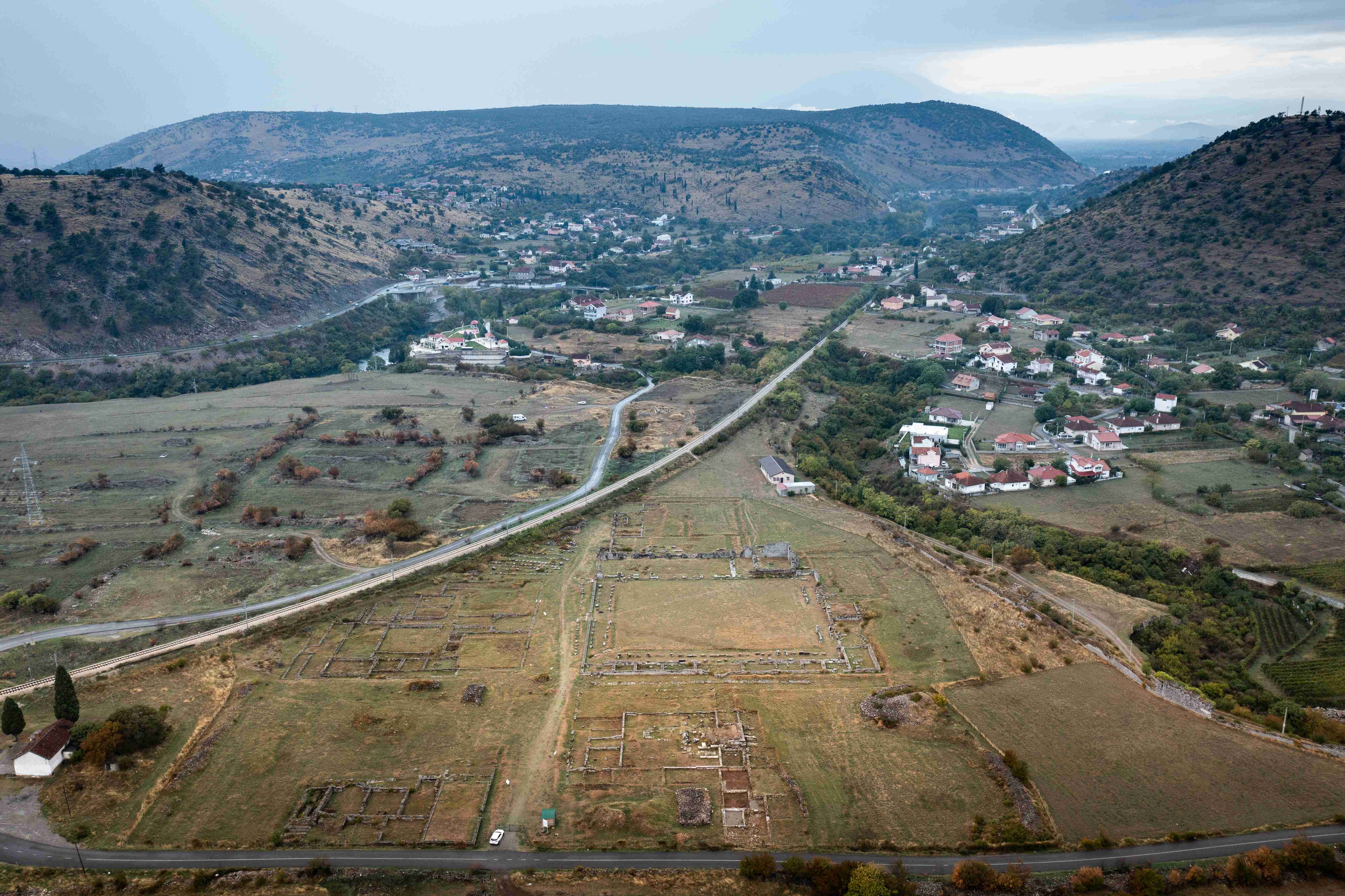
Bird's eye view of the Doclea archaeological excavation, the western part of the city in the foreground, Republic of Montenegro

Bird's eye view of the Doclea archaeological excavation, the western part of the city in the foreground, Republic of Montenegro

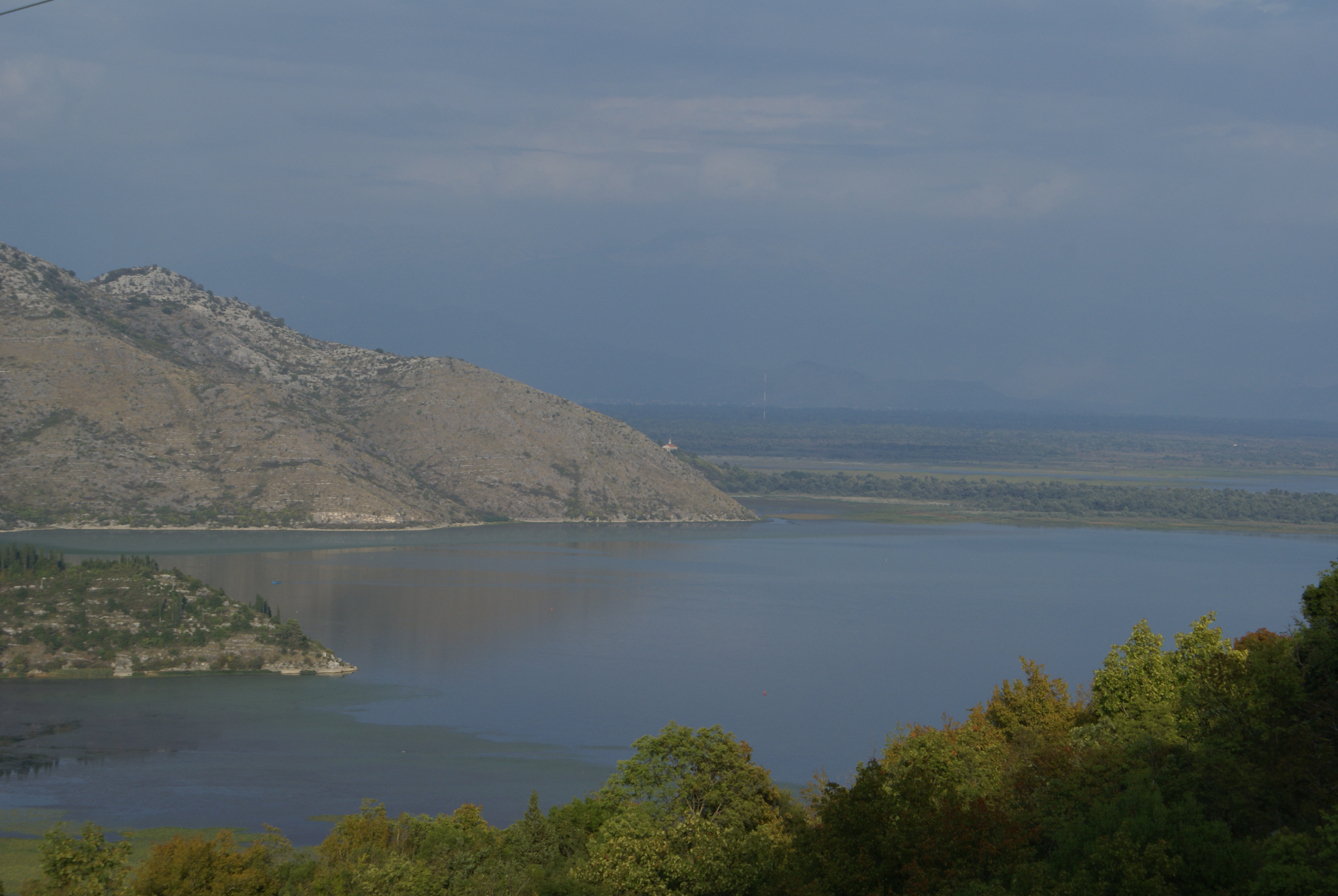
The monastery of Sveti Nikola Vranjina (in the centre of the picture) on Lake Skadar, Republic of Montenegro

The monastery of Sveti Nikola Vranjina (in the centre of the picture) on Lake Skadar, Republic of Montenegro

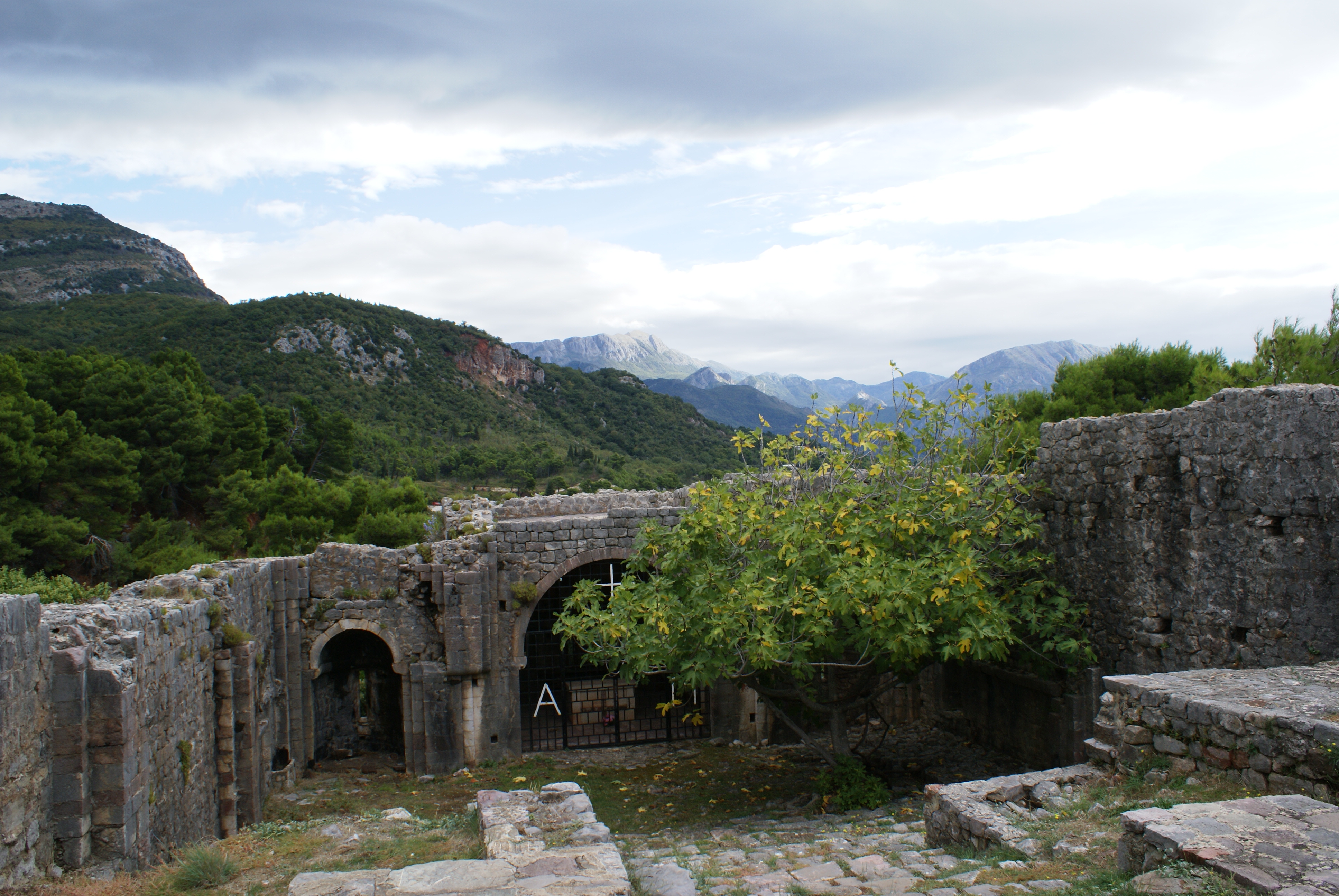
The former Latin (Catholic) monastery of Ratac from the 12th/13th century near the town of Bar, Republic of Montenegro.

The former Latin (Catholic) monastery of Ratac from the 12th/13th century near the town of Bar, Republic of Montenegro.

Results

The Team Department of Geography and Regional Research (University of Vienna) has created a customised homepage for our project’s Geocommunication: https://map.geo.univie.ac.at/bew/
Publications

Author Title Location Date Pages
Branka Vranešević Iconography of the Parapet Slab from the Church of St. Thomas in Kuti: New Reflections and Possible Interpretations. Zbornik Matice srpske za likovne umetnosti (in print) Novi Sad 2023
Katrin Haase, Johannes Tripps Jenseits von Ost und West, in: Forschungsmagazin der HTWK Leipzig Einblicke 2023 Leipzig 2023 5
Markus Breier, Karel Kriz, Alexander Pucher, Lukas Neugebauer Beyond East and West – Geocommunicating Historical Sacred Landscapes, in: Proc. Int. Cartogr. Assoc., 4, 14, 2021. (https://doi.org/10.5194/ica-proc-4-14-2021) Göttingen 2021 5
A. Bracanović, M. Breier, M. Hernández Cordero u. a. On the Crossroads between East and West: Geocommunicating Medieval Sacred Landscapes in Today’s Montenegro – First Project Results. DOI: 10.25536/2022q004 Krems 2022 33

Presentations

Presenter Title Conference Location Date
Mihailo St. Popović Serbian Noblewomen and the Clergy in the Middle Ages: A Comparison between Mara Branković and Jelena Anžujska regarding Athonite Monks and Franciscan Friars Workshop „A Special Relationship? Gender on Medieval Mount Athos“ Oxford 2023/09/29
Mihailo St. Popović On the Usefulness of OpenAtlas in Historical Geography Belgrade 2023/09/19
Johannes Tripps The Metamorphosing crown of Saint Stefan Decanski Belgrade 2023/09/07
Branka Vranešević Initials with Teratological Motifs in the Belgrade Prophetologion: Witnesses of Entanglement between East and West International Medieval Congress Leeds 2023/07/06
Johannes Tripps Objects of Private Devotion as Witnesses to Entanglement between Venice and the Árpád and Nemanjić Dynasties International Medieval Congress Leeds 2023/07/06
Mihailo St. Popović A Mother and Two Sons: the Serbian Rulers Helen, Dragutin, and Milutin and Their Entangled Realms in Medieval Serbia International Medieval Congress Leeds 2023/07/06
Bernhard Koschiček-Krombholz OpenAtlas: Handling Entangled Data in a Linked Data World International Medieval Congress Leeds 2023/07/06
Dorota Vargová Stefan Uroš I and Helen of Anjou: The Royal Couple's Influence on the Confessional Structure of the Principality of Zeta in the Late 13th and Early 14th Century International Medieval Congress Leeds 2023/07/06
Mihailo St. Popović Пројекат Tabula Imperii Byzantini: о будућности (?) проучавања историјске географије Византије Serbian Academy of Sciences and Arts – SANU Beograd 2022/02/22
Mihailo St. Popović Die historische Geographie von Byzanz neu gedacht – Über den Wert der digitalen Kartographie und Geokommunikation in der Vermittlung historischer Inhalte am Beispiel des Projektes „Jenseits von Ost und West“ Deutsche Gesellschaft für Kartographie e.V., Sektion Halle – Leipzig Leipzig 2022/11/10
Mihailo St. Popović Doing Historical Geography in A Digital Age: The Case of The Tabula Imperii Byzantini Balkans and Its Public Outreach 2022 Byzantine Studies Conference Los Angeles 2022/11/06
Mihailo St. Popović Historical Geography, Digital Humanities and Database Systems: an Approach to reconstruct “Sacred Landscapes” – the Case of Medieval Duklja and Raška (today’s Montenegro and Serbia) Global Eurasia, Workshop II: Handlungsspielräume, Netzwerke und transregionale Kontexte Wien 2022/05/12
Mihailo St. Popović On the Use and Usefulness of Digital Humanities in the Historical Geography of Byzantium Seminar Series: The Balkans Between Empires, Aristotle University of Thessaloniki, Ibn Haldun University Istanbul Thessaloniki 2022/04/01
Markus Breier Beyond East and West – Geocommunicating Historical Sacred Landscapes International Medieval Congress, University of Leeds Leeds 2021/07/07
Markus Breier, Karel Kriz, Lukas Neugebauer, Alexander Pucher Beyond East and West – Geocommunicating Historical Sacred Landscapes 30th International Cartographic Conference 2021 Florenz 2021/12/18
Dorota Vargová An Ecclesiastical History of Medieval Duklja: A Landscape Defined by Rite International Medieval Congress Leeds, Großbritannien 2022/07/06
Branka Vranešević Towards Imperial Dignity: A Contribution to the Study of the Imperial Crown of King Stefan Uroš III Dečanski in the Cetinje Monastery International Medieval Congress Leeds, Großbritannien 2022/07/06
Moisés Hernández Cordero Mapping Cultural Heritage beyond the Eye: The Case of the Crown of the Serbian King Stefan Dečanski International Medieval Congress Leeds, Großbritannien 2022/07/06
Mihailo Popović Beyond East and West: Sacred Landscapes in the Territory of Today's Montenegro, 11th-14th Centuries International Medieval Congress Leeds, Großbritannien 2022/07/06
Markus Breier Modern Cartographic Representations of Medieval Borders and Border Zones International Medieval Congress Leeds, Großbritannien 2022/07/06
Lukas Neugebauer Experiencing Historical Landscapes Using Visual Storytelling International Medieval Congress Leeds, Großbritannien 2022/07/06
Markus Breier Beyond East and West - A Framework for Researching and Communicating Historical Landscapes EuroCarto 2022 Vienna, Austria 2022/09/19
Markus Breier The Sacred Landscape of Medieval Montenegro: Map-Based Communication 5. Geographie-Werkstatt des Österreichischem Geographieverbands Vienna, Austria 2022/09/20