TIB Publications in the Making
The TIB Team is currently working on five new TIB volumes in Asia Minor and the Balkans
Learn more
Subprojects of the TIB
The TIB Team works in several subprojects on groundbreaking research
Learn moreLong-Term Project
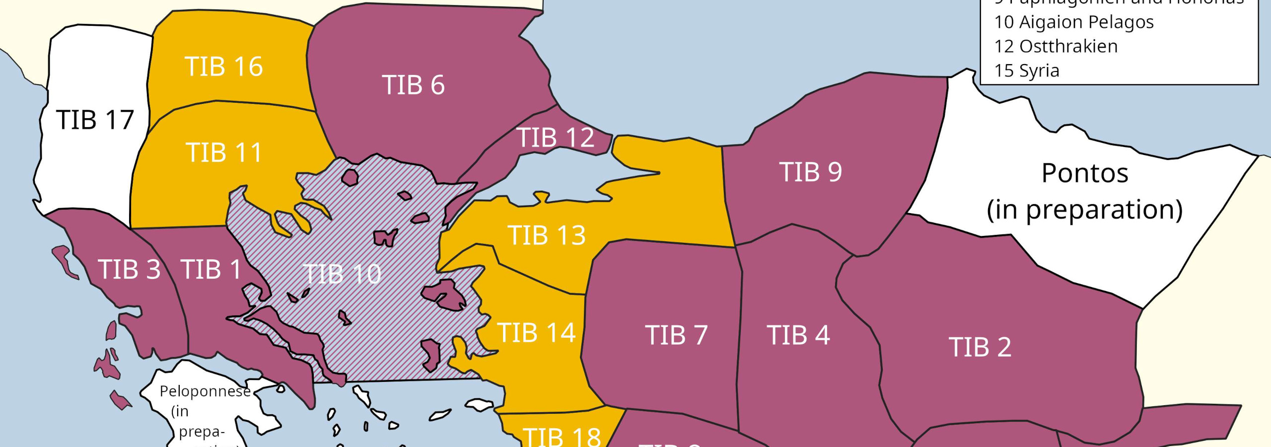
Tabula Imperii Byzantini
Research on the Historical Geography of the Byzantine Empire at the Austrian Academy of Sciences in Vienna is conducted by the Tabula Imperii Byzantini (TIB). This renowned project was accepted by the Union Académique Internationale in Brussels in 2015 (Project 87), and at the same time included into the scheme of Long-Term Projects at the Austrian Academy of Sciences, based on independent excellent international evaluations. The TIB carries out systematic research in the historical geography of the Byzantine Empire, from the beginning of the 4th century to the mid-15th century. The aim of the project is to create a historical atlas of the Byzantine space from Late Antiquity to the Early Modern period.
TIB Volumes Published
TIB Volumes in Progress
Articles published since 2004
Presentations held since 2006
Books published since 2006
and more pictures shot since 1966
and more travels accomplished
Individual regions are represented on maps on a scale of 1 : 800,000. A separate accompanying volume provides the results of further research in each region. Each volume contains detailed introductory chapters on geography and climate, borders and territorial designations, history, administrative history, church history and monasticism, traffic routes, economy and demographic trends. The main part of each volume consists of an alphabetical catalogue of all toponyms, hydronyms etc. that were known in Byzantine times. Also included are the historical places, whose historical names are unknown, but for whose existence there is (or there was) archaeological evidence. Written sources (from Late Antiquity to Early Modern Times) and archaeological materials elucidate the history of individual places, along with brief descriptions of monuments, both those that are known to have existed and those that are still preserved. The aforesaid results are enriched by systematic field research in order to verify, modify or complete the information of the sources.
Since 1986 new methods have been included into the scholarly work of the TIB, namely: studies of Palaeo-climate and settlement theories (for example the modified "Central Place Theory"), as well as the regular use of the Global Positioning System (GPS) during field missions and surveys. Digital Humanities, e.g. in the form of Historical Geographical Information Systems (HGIS), further contribute to the analysis and interpretation of the research data.
TIB
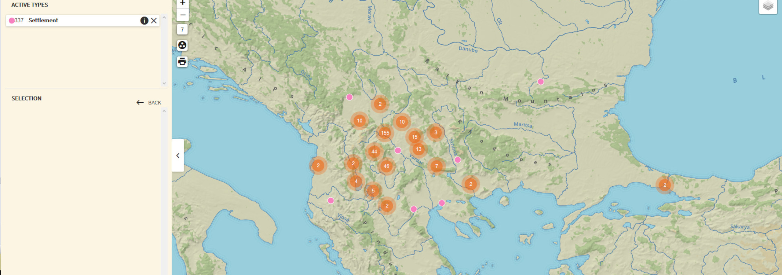
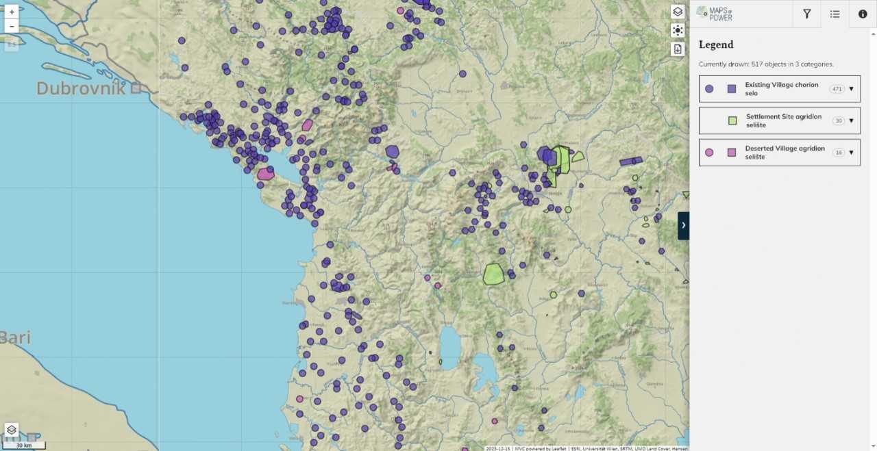
Map Application
The new frontend ‘Maps of Power’ is available. Further information: maps-of-power.oeaw.ac.at
Activities
The TIB Balkans at the IMC Leeds 2023
Congress on Byzantine Thrace
Presentation at the Serbian Academy of Sciences and Arts
Presentation in Barcelona
Promotion Event for TIB 11
Presentation in Leipzig
Blogpost on the Paper 'OpenAtlas und historische Geographie'
TIB volume 11, Macedonia, Southern Part published
Presentation at International Medieval Congress (IMC) in Leeds
TIB at the 'Lange Nacht der Forschung' in Vienna
Presentation at 'Global Eurasia – Comparison and Connectivity II: Agency, Networks and Transregional Contexts'
On the Use and Usefulness of Digital Humanities in the Historical Geography of Byzantium
![['seminar_series_april']](/static/images/gallery/outreach/seminar_series_april_1.jpg)
![['seminar_series_april']](/static/images/gallery/outreach/seminar_series_april_2.jpg)
![['seminar_series_april']](/static/images/gallery/outreach/seminar_series_april_3.jpg)
![['seminar_series_april']](/static/images/gallery/outreach/seminar_series_april_4.jpg)
![['seminar_series_april']](/static/images/gallery/outreach/seminar_series_april_5.jpg)